


These are maps created on ArcMap about the population in 2000, the difference in the population between 1990 and 2000, the percent change from 1990 to 2000 of the total population, and the population density in 2000 of the United States. It was interesting to see the maps change color depending on what information is put in. It was easy to see the distribution of everything based on the colors. The colors also change depending on what break value is inputted so more of one color might show up depending on what the values are. The instructions on how to create these maps was fairly easy to follow, so I did not have any problems completing this lab. This function is extremely efficient at displaying data on a map, the data is easy to understand.
The first map is about the number of people in the United States in the year 2000. It is based on the column labeled APRO1_2000 from tab01. From the map, the United States is less populated in the middle and more populated to the southwest and northeast. For all the maps, the projection was changed to North American Lambert Conformal Conic. The Census 2000 data in tab01 and the Counties shapefile were joined using the column ST_CO_FIPS as the key field.
The second map is about the difference between the population in 2000 and the population in 1990. There are some areas where the population change has a negative value, which means people are moving away from those areas. The color for the negative values show up mainly in the middle of the United States. The field used for this map is POP_CHANGE. The southwest of the United States has the largest area of a population increase between 1990 to 2000.
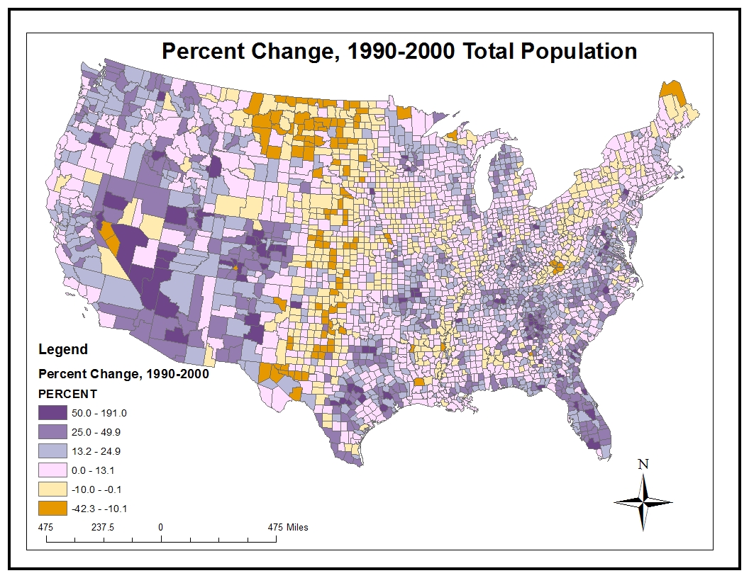
The third map is about the change in percentage of the population between 1990 and 2000. It is similar to the second map, but this one is using percentage instead of the number of people. The break values for this map is different from the second map so the areas with the same color do not match up. The counties in orange had the greatest drop in percentage of their population.
The final map is about the population density of the United States in 2000 in units of people per square mile. For this map, the data used was under the column labeled POP00_SQMI. I used the field calculator to fill in this field in the Attribute Table with the expression [Tab01.APRO1_1990] / [Counties.AREA]. The northeast of the United States along part of the east coast has a large area where it is densely populated. There are also parts where the population density is extremely small.
No comments:
Post a Comment